Your scan.
Anywhere.
Pointclouds Viewer opens laser-scanner point clouds on your Mac, iPad and iPhone. Measure on real points, cut out a room, set an IFC model beside the scan and see where the building differs from the drawing. All on the device — no account and no upload.
Free with one project · Pro as a single payment · macOS 14+, iOS and iPadOS 17+
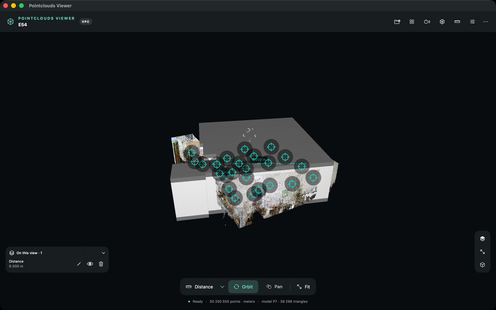
The synthetic room we sent Apple for app review — no client’s data. The model’s north wall is drawn 4 cm out on purpose. Switch on Measure, click the wall in the scan, then switch off Cloud and click the same wall in the model.Download the sample data ↓
Office. Site.
Train.
On a Mac with a mouse and keyboard, on an iPad with your fingers, on an iPhone in your pocket on site. Import turns a scan into an offline project on the device, once, and never touches the original file. After that it simply opens — at once, with no network.
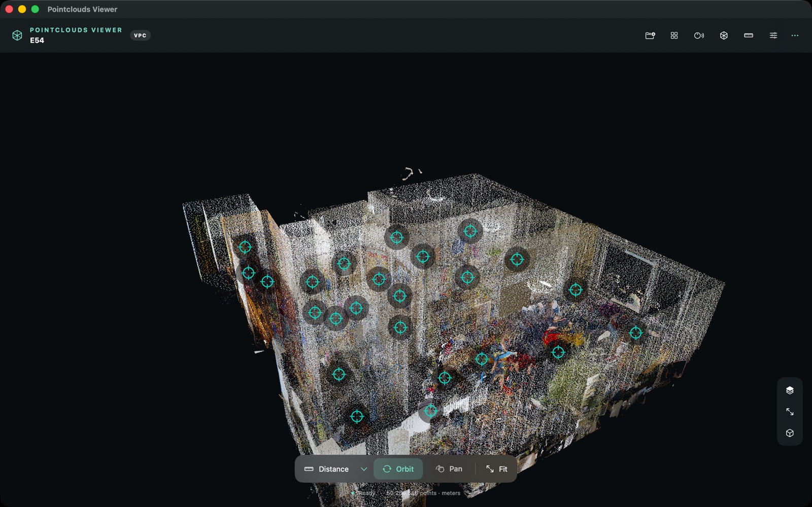
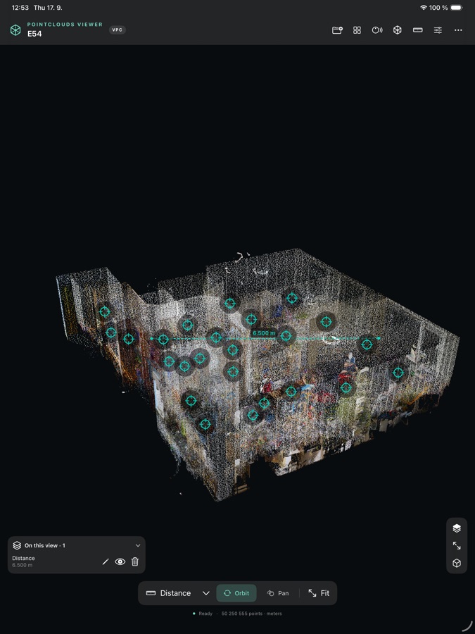
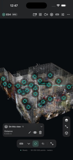
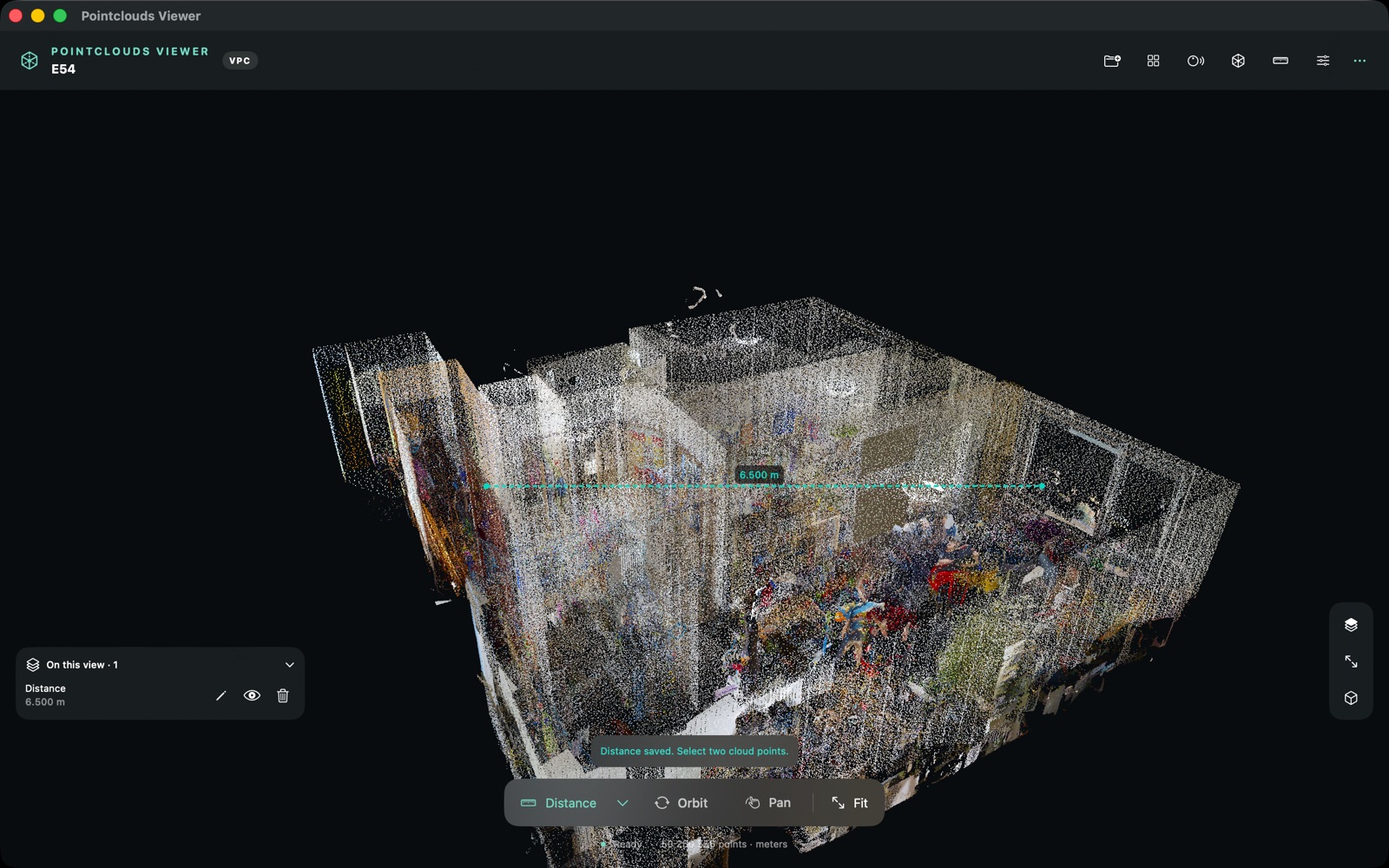
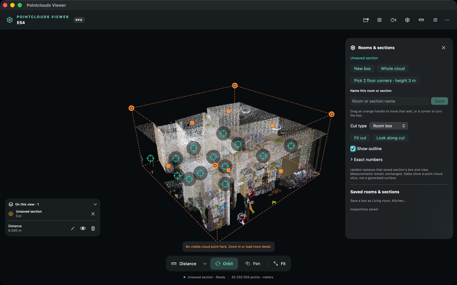
Screenshots of the real app: a flat scanned from 24 setups, 50,250,555 points.
Measured on points.
Not by eye.
Every pick is verified against the cloud at full resolution. When the app is not sure, it refuses the pick — no number at all is better than one that only looks precise.
- Distance, with its horizontal and vertical components
- Polylines and angles
- Best-fit areas that report how far the points sit from the plane
- Notes anchored to a point
- Measurements are saved in the project and restored when you open it again
Where the building
differs from the drawing.
Open an IFC model beside the scan. Place it by an estimate from its extents, by dragging it in the view, or by exact steps of a centimetre. A measurement can then run from a point on the scan to a surface on the model — how far the built thing is from the drawn one.
The model is what moves, never the scan. The scan is the measurement; the model is the intention.
Placed without coordinates
A model sitting a hundred metres from the scan comes over by an estimate from its extents. Fine-tune by dragging or in centimetre steps. Scale is never changed.
Scan ↔ model measurements
From a point on the scan to a surface on the model. Saved in the project like any other measurement.
Sections cut the model too
A clipping box, a plane or a slab cuts the model along with the cloud, so one room shows just that room.
Everything you actually
do with a scan.
Sections and rooms
A clipping box that rotates around the vertical axis, a plane, or a slab of a given thickness. Save a cut together with the camera view under a name — Living room, Kitchen — and return to it any time. Clipped points are not drawn, not loaded and cannot be picked.
Scanner panoramas
Scans that carry photographs show a panorama from the scanner’s own position — on its own, or over the cloud. Sets of perspective photos per setup are assembled into a panorama during import.
Panorama + cloudColour as you need it
RGB, intensity, elevation, a heatmap, or LAS point classification — ground, vegetation, buildings — each in its own colour.
Big scans, little memory
Reading is streamed. A scan of over a hundred million points imports within a few tens of megabytes of working memory, and detail follows where you look.
100 M+ pointsMany files, one project
Import several files at once and they become one project with all their setups.
Export
CSV with one row per vertex, JSON of the whole inspection file including sections, and a PNG snapshot with its markers. JSON can be imported back and merged.
Project library
Points, size on disk, setups and photos at a glance. Projects on iCloud Drive or an external disk stay reachable after a restart.
Walk through the scan
On a Mac, W, A, S and D move the camera through the scan and the arrow keys look around. Orbit turns around the point you grab.
MacOpens what your
scanner writes.
Registered scan setups, colour, intensity and spherical photographs.
Versions 1.0 to 1.4, colour, intensity and point classification.
ASCII and binary, little and big endian.
With intensity or RGB columns.
A model opened beside the scan as its context.
PLY and XYZ carry neither units nor an up axis, so the import asks — and shows a plan and a side view, so you can tell where the floor is. E57 and LAS carry their own coordinate system.
Nothing is sent anywhere.
The app has no networking code. No account, no upload, no analytics. A client’s scan stays where it belongs — on your device.
It never connects to the internet. Not at launch, not during import, not on failure.
Nothing to register, nothing to sign in to, nothing to expire.
No analytics, advertising or telemetry. App Store: Data Not Collected.
Import creates a project of its own. The source file is never modified.
What the app does not do.
Better to state the limits up front than to let anyone find them after buying.
- It does not edit point data. Points are not deleted, cleaned or recoloured.
- It does not register scans. Setups must already be registered in the source file.
- There is no AR.
- It does not unify coordinate systems. Clouds in two different systems are not brought into one.
- A model is drawn as a whole. Individual elements cannot be selected.
- Property sets, BCF and IDS are not read, and where a model was placed is not stored with the project.
For people who
work with scans.
Surveyors
Check the survey on an iPad while you are still on site, before you drive away.
Architects and designers
Verify a dimension on the building as it stands, not on old drawings.
BIM coordinators
Set the IFC model beside the scan and measure how far the building is from it.
Site managers and supervisors
The scan and the model in your pocket — even where the site has no signal.
Free. Pro, once.
The app is free and keeps one project. Pro removes that limit for a single payment. No subscription.
- Viewing, measuring, sections and panoramas
- An IFC model beside the scan
- Export to CSV, JSON and PNG
- Mac, iPad and iPhone
- Removes the one-project limit
- Paid once, never a subscription
- Restore the purchase on other devices with the same Apple Account
The App Store shows the Pro price in your currency. Projects you already have always stay openable — the limit only applies to adding another.
No scan to hand?
Take ours.
The same synthetic room as the demo, at full resolution: 639,687 points from two setups, colour, intensity and a panorama for each setup. The room is exactly 6.000 × 4.000 × 2.700 m, so you can check on round numbers that the measuring does not lie. With it, an IFC model with one wall moved 4 cm on purpose.

Pointclouds Viewer is made by Virtalia, a Prague company working in BIM and the digitalisation of construction. The app stands on its own and works with data from any scanner. And if you ever need help with a scan or a model, you know where to find us.
virtalia.czOpen your
first scan.
Free for Mac, iPad and iPhone.
Offline · No account · No subscription